26 May 2005

Wine Spring Bald to Nantahala Outdoor Center

Appalachian Trail, 19.1 miles

Man, I thought this day would never end. Who knew I would clock out at over nineteen miles!?? Shock and awe all the way around.

I woke up early (about 6:40) and made it my first priority to peer warily out of the tent to see if my food bag was still intact. There it was, hanging in the tree, undisturbed. I was so proud of myself for having made it through my first night alone. No bears, no wild pigs, and no bobcats. At least none that woke me up.

So I packed up and off I went as the sun was rising. I summitted Wayah Bald about 7:45 a.m., and man, what a view! It was my favorite part of the day. There is this really cool old stone lookout up there, and the added bonus of both a trash bin and a real bathroom (not a privy) nearby! Yeah baby!

The rest of the day is pretty much a dizzy blur of peaks and gaps, peaks and gaps. Oh and did I mention more peaks and gaps? I had decided early this morning to just go as far as I could go today, vaguely planning to stop at either Wesser Bald Shelter or Rufus Morgan Shelter. I gave my feet a good long rest every five miles or so. I discovered that if you take your boots and socks off and let everything dry out for ten or fifteen minutes, you sort of trick your feet into thinking it's a new day when you put your boots back on.

I stopped for a long lunch break at Tellico Gap and met a very polished-looking couple from -- whaddayah know -- Michigan! They drove up, parked their SUV in the gravel near the trailhead, and told me they wanted to do a one- or two-hour hike and was this a good place to do it? I think I was a little over-eager for the human contact (I hadn't seen a soul in nearly 24 hours), and the fact that they were from Michigan, well, it practically meant we were kin -- so I chirpily launched into a very long and detailed explanation of all the balds and mountains they could get to from there. Of course I also pulled out my giant AT map with great flourish and pointed out every nuance. They were quite chagrined to find that, from the place we were standing, every trail led uphill. That's kind of how it is when you're in a gap, people. They thanked me politely and as I went on my way toward Wesser Bald, I heard their SUV start back up and off they went, I guess in search of a flat trail. Bet they looked for a long time.

Wesser Bald was really cool, and my last big peak before beginning the six-mile descent toward US19. There was a rickety old lookout tower at the top that I almost chickened out of climbing, but I thought, silly girl, how can you hike all this way, make it to the top of a mountain, and then bypass the chance to climb just 200 more steps to the top of that tower? So I shakily ascended this flimsy wood-and-metal structure, feeling the thing wobble and lean with each step. At the top, I snapped one hurried picture (which didn't turn out so well because I was shaking from fright and couldn't steady the camera), and then slithered my way back down the steps, praying all the while that the thing wouldn't collapse with me on it.

I could've stopped at Wesser Bald Shelter, which was just downhill from the tower, but instead I took a brief break there and then kept moving. It was only about 2:45, and in the back of my mind I kept thinking that if I could just make it to Rufus Morgan Shelter, it would be my highest mileage day ever. (Thus far my record had been 17.5 miles.) Onward!

I loved the rest of the day. There were some amazing rocky downhill scrambles, some short but intense climbs, and lots of really great views of the Smokies. And I knew all too well that every step I took was bringing me closer to a shower and hot food. As I hiked, I solidified my plan to spend my final night on the trail at Rufus Morgan, and then swagger with bravado into NOC to relish a huge bacon-and-egg breakfast in the morning. A few times I thought I even smelled the bacon leading me down the trail.

It was 5:15 when I reached Rufus Morgan and I collapsed for about half an hour, not caring (at first) that the shelter was probably the worst one I'd seen to date. Then, as I started unpacking and getting my gear situated, I noticed not only the dilapidated condition of the shelter, but also the fact that once again, I had chosen to pass the night in a place where there was no bear cable. Ah well, no matter, I thought; I'll just find a suitable tree -- after all, I'm practically an expert now at bear-bagging my food. But a quick analysis of nearby trees turned up no decent branches that I could possibly use. Had there been other hikers there to share the shelter with me, I would've been okay with just hanging my food on the mouse lines in the shelter overhang (like I had done that first night at Muskrat Creek Shelter). But I was alone. Totally and utterly. And it was unrealistic to think that any other hikers would show up this late. Should I stay? Go? I was only about a mile from NOC, so I could pretty easily finish out the hike in half an hour. But moving on meant finishing the trail a day early, and having nowhere to go once I reached my car! And I sure as heck didn't want to start driving back north in my current state of near exhaustion.

So I prayed that God would show me what to do. As I sat there contemplating my options, my eyes focused on a fire ring near the shelter and to my horror I noticed it was full of the remnants of some previous hiker's dinner! Noodles, pretzels, apple cores, something that resembled beef stew... all just sitting there, an open invitation to all wild animals to come and hang out for the night. That clinched it for me -- no way could I get a decent night's sleep knowing that there was a veritable bear/pig/bobcat buffet six feet from my head. So I packed everything up, muttered a halfhearted apology to my feet, and continued on toward NOC. Halfway there, in the middle of the trail was an enormous deposit of bear scat. It made me glad I hadn't stayed at the shelter.

So I finished the trail on a somewhat anticlimactic note. By the time I got to NOC it was 7:30 p.m. and the office, store, and restaurant there were closed. Hardly a soul to be seen. So, no chance of bunking in their hiker hostel or smugly swapping trail stories with other hikers while putting on subtle self-congratulatory airs. There really was no one there to appreciate what I had just accomplished, except me. Just as well. Because that's who I did all this for anyway.

I got in my car and drove about 15 minutes back to Bryson City and found myself at the Ridgeway Motel -- a throwback from the 1950's whose proprietor looked like he had just walked off the set of the Andy Griffith Show. It was perfect. I called my honey, washed my filthy clothes and my filthy self, and slept like a baby.

Oh, and I still managed to score that bacon-and-egg breakfast at a diner the next morning. So far, 134.1 miles of the trail down, 2,035.9 to go.

Hiking time: 9 hours, 10 minutes (12:10 with breaks)
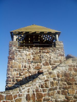
Stone lookout at the top of Wayah Bald

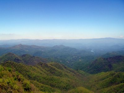
View from the tippy top of the lookout tower on Wesser Bald. Way out in the distance you can barely make out the Nantahala River.

25 May 2005

Rock Gap Shelter to Campsite on Wine Spring Bald

Appalachian Trail, 12 miles

Slept in a bit since I was in no hurry to get started today. I planned a low-mileage day -- only 7.5 miles -- but adjusted that plan later in the day. There was a beautiful full moon out this morning about 6 a.m. when I woke up. I went back to sleep till about 8. I could get used to this. My initial plan was to hike to the Siler Bald Shelter today and spend the night there.

Okay, before I go on, the word "bald" needs some discussion. Yank that I am, I had only ever heard the word "bald" used to describe people, not mountains. Turns out, a bald is basically a mountain with no trees on top -- just a broad grassy expanse. There's a lot of debate about what created these open spaces. Theories include fire, drought, insects, harsh weather extremes... some people even think that white settlers cleared these mountaintops as places for grazing their animals. (That theory seems a little odd to me... why would you march your herd 5,000+ feet up a mountain to graze?)

Anyway, it's kind of a surreal feeling to emerge from the tree canopy onto a broad, grassy mountaintop where you can see for miles. And that's what happened to me... I reached the top of Siler Bald (and the beginning of the shelter side trail) at about 1:30 p.m. Being so early in the day, it just didn't feel right to stop. Plus the side trail to the shelter was .6 miles long, and I thought I'd be better off investing my mileage in a forward direction rather than off to the side... so I pressed on, admittedly a little nervously, because that decision meant I was bypassing my only chance to sleep in a shelter tonight. I'd have to find my own stopping point and get out the ol' tent.

I ended up rounding out the day at 12 miles, and stopped at a little clearing near the top of a bald called Wine Spring. Doesn't that sound like a place you'd want to stop after hiking 12 miles? It is really beautiful here. My tent is up, a bear rope has been tied into a nearby tree for my food (and it sure as heck better work), my feet are up, and all is well. There are lots of birds around. I've been hearing a woodpecker pretty much nonstop since I got here. Hope he goes to bed when I do.

My cold is still plaguing me. Today, at Pete's suggestion, I perfected the very unladylike "farmer nose-blowing technique" -- that is, blowing my nose without the aid of a Kleenex. Sure makes a girl feel primitive. But desperate times call for desperate measures, and I'd rather save my dwindling Kleenex supply for use in the privy.

I was delighted to find that my phone works up here (I'm pretty high up -- about 5,400 feet) and once I got situated I dialed into my voicemail and got to hear messages from both Jay and Janet. That was a treat -- I miss my homies!

So it looks like tonight I'm all alone, in my postage-stamp-sized tent. I've set the thing up so that I can peek out the screen and get a good look at my bear bag. If my food's gonna go down, I at least want the thrill of watching it happen.

Hiking time: 5 hours (6:20 with breaks)

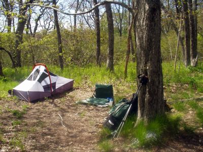
My little campsite near the top of Wine Spring Bald

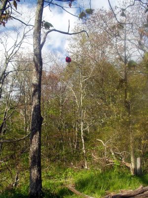
That little bundle hanging way up there under the tree limb is my food. Go ahead and admit how impressed you are that I got it up that high....

24 May 2005

Carter Gap Shelter to Rock Gap Shelter

Appalachian Trail, 12.1 miles

Today's biggest accomplishment was summitting Albert Mountain, which kicked my tail. It was quite a scramble -- lots of hand-over-hand climbing, but what a rush when I finally got to the top! It was sunny, 70, and clear. Or as clear as it gets around here anyway... even on a clear day the Smoky Mountains still look, well... smoky. But could I ask for more? I think not!

As a bonus, my phone worked on the top of Albert so I was able to call Michigan and Maryland. Unfortunately, Jay wasn't home, so I had to leave a message. I really miss him. I did talk to Pete, though, and found out his test went well today -- yay! I really prayed for that. I wish I would've remembered to tell him how much I'm liking my trekking poles.

After conquering Albert I felt like I could pretty much do anything, I was so happy. But rather than speed-race all the way to the shelter, I took a long, leisurely lunch break at Long Branch Creek. My feet appreciated it. Speaking of the dogs, I used some stuff on my feet this morning called Body Glide. (Ed, the thru-hiker from the other night, gave me some to try.) It's an anti-friction product used by surfers, bicyclists, and anyone else who has problems with chafing or blisters. It looks like a miniature container of deodorant. Anyway, it worked great... no blisters all day long. I'll have to pick up some of that stuff.

The Rock Gap Shelter has a bear cable (the first I've seen in NC), but the shelter itself is kind of old and creepy. And I don't like the fact that it's so close to a road. They say that the best way to avoid crime on the trail is to stay far away from roads... so I was getting a little wigged out when it looked like I would have to stay here all night alone. I was really glad to see Randall, another hiker from last night, show up around 4:30. I never mind company at night. I haven't had to stay anywhere alone at night yet; I'm wondering if that will happen this trip...

Found out from Randall that Ed the thru-hiker saw a bobcat on his way out of Carter Gap this morning. Bears, then wild pigs, now bobcats. Is God mercifully making these beasts invisible to me so that I don't go charging terrified down the mountain and call Fred The Shuttle Man to take me back to my car? Or am I just so way off in my own thoughts that I'm oblivious to everything around me? Another case in point: at the top of Albert today two different people asked me, "Did you see that dead bear on the side of the trail as you came up to the summit?" Nope. Missed that. It blows my mind that I could be THAT inattentive! I guess I was so fixated on getting to the top of the mountain without causing heart stoppage that I couldn't see beyond the step or two in front of me. Makes me wonder what else I'm missing.

God is teaching me about small steps today... that even a slow, pitiful, tiny step is still a step toward the goal, and it's not always so important how fast I get there.

Highlights of the day: Summitting Albert Mountain, passing the hundred-mile mark on the AT.
Hiking time: 5 hours (7:15 with breaks)

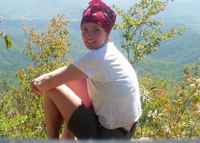
Me on the top of Albert Mountain

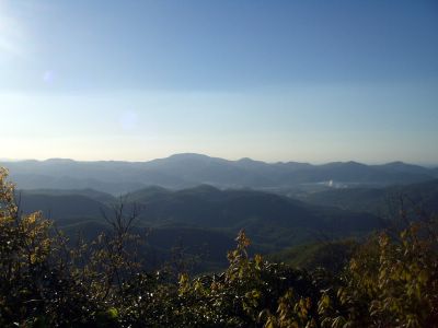
The view from Albert

23 May 2005

Muskrat Creek Shelter to Carter Gap Shelter

Appalachian Trail, 12.5 miles

Another hard day, but I'm feeling a lot better than yesterday. It helps to get an early start. It threatened rain this morning, but nothing ever came of it, so I'm really thankful for that. I'm still really congested, though, and I'm worried I'm going to exhaust my Kleenex supply. I really didn't bring enough for potty needs and nose-blowing...

Today was my longest mileage day of this trip. I summitted Standing Indian Mountain at about 11:45 -- it's the highest point I'll reach all week. I actually enjoyed the long, slow burn up the mountain.

I liked my poles even more today -- I think they're really helping me avoid fatigue in my knees.

Tonight's shelter, like last night's, has no bear cable. I wonder if that will be the norm in North Carolina? It bothers me a bit, but again, it's not so scary as long as I'm not alone. Tonight three other solo hikers showed up, so I'll let them fend off any bears.

I took a cold pill after dinner. I had hoped to avoid doing that, but the congestion was really getting to me. It's nice to be able to breathe through my nose for a little while.

Wayne, one of the other hikers, went out for a brief walk after dinner and came back white as a sheet. Apparently he was bumbling along, minding his own business, when he was approached by a small herd of wild pigs. Excuse me? Like the hakuna matata variety? No one told me there were wild pigs out here. Now I have to think about bears and pigs? Luckily they veered off the trail and left Wayne alone... I hope they do the same for me if I happen upon them.

Ed is a thru-hiker at tonight's shelter who reminds me of what Jay will be like in 25 years or so. He is a sweet, happy, joyful man, mid-sixties, who absolutely loves to take pictures. He tells me he takes about seven pictures for every mile that he hikes. He says he only travels about a mile and a half an hour because he's always stopping and fiddling with his camera. This made me understand why his wife didn't hike with him -- she would've killed him by now.

Tomorrow after I'm done hiking I get to change my clothes -- yay me! I'm sure I stink to high heaven.

Hiking time: 5 hours, 18 minutes (6:50 with breaks)

Wildflowers along the trail between Muskrat Creek and Carter Gap

22 May 2005

Dicks Creek Gap to Muskrat Creek Shelter

Appalachian Trail, 11.6 miles

What ever possessed me to think that this trip would be easy!? Oh my word, I thought I was in shape. Note to self: running five kilometers, three or four times a week, does not adequately prepare oneself for the trails in Georgia and North Carolina. Conclusion: the best thing to prepare your body for hiking the AT is... well... hiking the AT. Next time I will have to remember to give myself a day or so to get my trail legs.

It didn't help that I am on day three of a nasty cold. I am hoping this congestion goes away quickly. With all this snorting and sniffling, I'm worried I might be mistaken for Mary Ellen, that pitiful character in Bill Bryson's book, A Walk In the Woods.

I got a bit of a late start (10:15 a.m. or so) because I first had to park my car at Nantahala Outdoor Center and have Fred The Shuttle Man drive me to Dicks Creek Gap. I noticed right away that Fred held me in higher regard this time than last, when I was just a newbie. I think that my hiking 75+ miles in six days last October proved to him that I wasn't such a cupcake after all. (He might've thought differently, however, if he had seen how I clawed my way up Court House Bald, gasping for oxygen, mere hours after he dropped me off...)

Today was my first crack at using my new Leki trekking poles (thank you Pete and Cindy!), and I must say, being a quadruped took some getting used to. For the first hour or two I wanted to fling the dang things into the woods -- I just couldn't get any kind of smooth movement going, and it felt like they were really slowing me down. Once I quit trying so hard though, my legs and arms just fell into their own rhythm, sort of like cross-country skiing. By the end of the day I kind of came around -- now I think they're actually pretty useful.

The sand and rock here seem to be really quartz-y. When I stopped for a break today I happened to be studying the ground (translation: hunching over, leaning heavily on my Lekis, wondering if my lungs were going to explode right out of my chest) and I noticed that it almost looked like someone had spilled a bottle of glitter on the ground. Kind of pretty.

I misread my map and stumbled upon Muskrat Creek Shelter about a quarter mile earlier than I expected. First time in my hiking history that I've actually been ahead of where I thought I was... anyway, I just about danced a jig when I caught sight of the shelter. I suppose that would've rather alarmed Peter, a mild-mannered gentleman who had already staked out his side of the shelter and was beginning to cook his dinner. He turned out to be good company for the evening... he is fiftyish and recently retired from his position of VP at North Sails. Must remember to tell Dad about him. We chatted about Annapolis and sailing for a little bit, exchanged some stories about bats and hiking, and then I collapsed in a heap and slept all night.

There was no bear cable at this shelter, so we hung our food from a little mouse-proof (but definitely not bear-proof) suspension thingy in the overhang of the shelter. As the old joke goes, I figured I was safe from any bear that came along, as long as I could outrun Peter.

Saw lots of wildflowers today, one beautiful butterfly, and a pretty doe that wandered close to the shelter at dusk.

Highlight of the day: Finishing the Georgia section of the AT.
Hiking time: 5 hours, 2 minutes (7 hours with breaks)

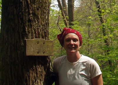
Hard to make it out, but the sign here says "NC/GA" -- it's the state line where I put the Georgia section of the trail behind me.

Butterfly along the trail to Muskrat Creek Shelter

21 May 2005

So, it's Trail-Launch Eve again...

....and I'm sitting here at a greasy diner in a little burg called Bryson City, NC, after driving all day. Tomorrow I start the next section of my Appalachian Trail hike.

I decided to take a different route south this time, so I could avoid the snarl of Pigeon Forge traffic and the tourists in Great Smoky Mountains National Park. So, I approached the trail from the west, on US129, which appeared (on my map, anyway) to be a lesser-traveled, straighter shot toward the trail. Smart, huh? I thought so too, till I got ten minutes down that road (which, for the record, is every bit as twisty and treacherous as the Blue Ridge Parkway in GSMNP) and suddenly found myself in the midst of a great horde of ageing, long-haired, leather-clad motorcyclists.

My mind flashed back to a sign I had seen in front of a church a few miles earlier: "Bikers Welcome." At the time, I had thought, "Hmmm, interesting ministry niche..." Now it all made sense. I soon learned from the banners strung about at the roadside parking areas that they were having a weekend-long rally called "Waken the Dragon." Sounds like an event where I'd fit right in, don't you think?

So, for about 28 torturous miles, I white-knuckled it around more hairpin curves than I care to remember, at a maximum speed of 25 mph, with at least 30 bikers fore and 30 aft. No exaggeration. I wanted desperately to pull over and let them pass, but all the pull-off spots were teeming with -- you guessed it -- more bikers, having the Hell's Angels version of a tailgate party. There were hundreds of them, sitting in lawn chairs, barbecuing, swilling Cokes.

So I just kept driving. Conspicously. In the middle of several dozen bikers. Oh yeah, you blend.

I exhaled violently in relief when the pack of Hogs in front of me spotted and claimed an empty pull-off area. But to my horror, the pack behind me stayed right on my tail. Good grief, now I was leading this parade! Judging from the backfiring and motor-belching sounds their cycles were making, I guess I was driving a bit too slow for their taste. Suspicion confirmed when suddenly they engulfed my little Altima, passing me with a deafening roar that left the air smelling a little like the afterburn of a cap gun.

When they were out of sight and my ears stopped ringing, I considered that maybe the Pigeon Forge tourists wouldn't have been so bad to deal with after all.

01 May 2005


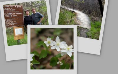
Photos by Jay, from our day on the Potowatami

Trail as Therapy

Cindy had the kids overnight and all day Saturday, so early in the week we decided we'd spend Saturday on the Potowatami. We ditched that plan Friday night because of rain in the forecast, but in the morning we woke up to only clouds (no rain), so we reverted to plan A, throwing some water bottles and snacks in the backpack and heading out to the trailhead at Silver Lake. We did the whole 17.5-mile loop in about six hours (5:10 not including breaks), and the first drops of rain fell just as we were climbing (crawling) back into the car at about 2:15. We were spent but happy.

The Poto was delightful as always, but what really hit me this time around is how therapeutic it was to spend the whole day hiking alongside my honey. Life is hard (no secret there) and our moments alone are few and far between. When we do get away for an evening here or there, it always seems so abbreviated. And so expensive! Dinner + sitter + movie can easily top a hundred bucks. Then we both feel this unspoken pressure to make that time "worth it" and meaningful. The problem is compounded if things don't go according to plan -- like on Friday night when we thought we'd see a movie together, and blindly walked into probably the lamest film we've ever encountered. (Apologies to those of you who somehow enjoyed The Hitchhiker's Guide to the Galaxy).

So Saturday morning we spent six uninterrupted hours together, surrounded by trees and flowers, talking when we felt like it, but comfortable being silent too. It is the best way of reconnecting that I know.