26 May 2005

Wine Spring Bald to Nantahala Outdoor Center

Appalachian Trail, 19.1 miles

Man, I thought this day would never end. Who knew I would clock out at over nineteen miles!?? Shock and awe all the way around.

I woke up early (about 6:40) and made it my first priority to peer warily out of the tent to see if my food bag was still intact. There it was, hanging in the tree, undisturbed. I was so proud of myself for having made it through my first night alone. No bears, no wild pigs, and no bobcats. At least none that woke me up.

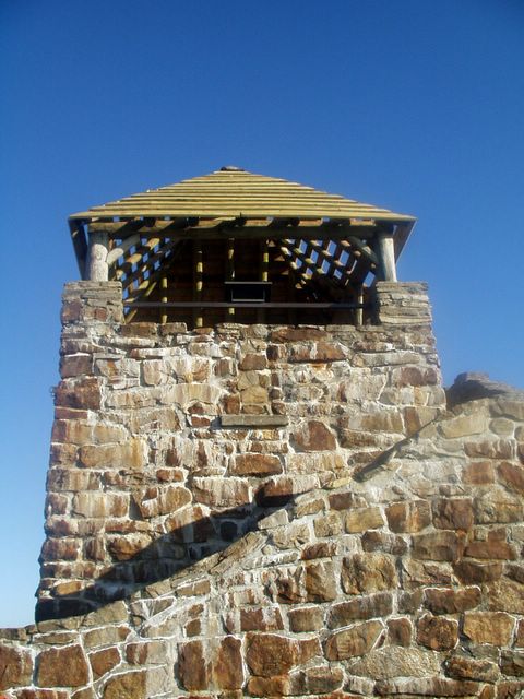
So I packed up and off I went as the sun was rising. I summitted Wayah Bald about 7:45 a.m., and man, what a view! It was my favorite part of the day. There is this really cool old stone lookout up there, and the added bonus of both a trash bin and a real bathroom (not a privy) nearby! Yeah baby!

The rest of the day is pretty much a dizzy blur of peaks and gaps, peaks and gaps. Oh and did I mention more peaks and gaps? I had decided early this morning to just go as far as I could go today, vaguely planning to stop at either Wesser Bald Shelter or Rufus Morgan Shelter. I gave my feet a good long rest every five miles or so. I discovered that if you take your boots and socks off and let everything dry out for ten or fifteen minutes, you sort of trick your feet into thinking it's a new day when you put your boots back on.

I stopped for a long lunch break at Tellico Gap and met a very polished-looking couple from -- whaddayah know -- Michigan! They drove up, parked their SUV in the gravel near the trailhead, and told me they wanted to do a one- or two-hour hike and was this a good place to do it? I think I was a little over-eager for the human contact (I hadn't seen a soul in nearly 24 hours), and the fact that they were from Michigan, well, it practically meant we were kin -- so I chirpily launched into a very long and detailed explanation of all the balds and mountains they could get to from there. Of course I also pulled out my giant AT map with great flourish and pointed out every nuance. They were quite chagrined to find that, from the place we were standing, every trail led uphill. That's kind of how it is when you're in a gap, people. They thanked me politely and as I went on my way toward Wesser Bald, I heard their SUV start back up and off they went, I guess in search of a flat trail. Bet they looked for a long time.

Wesser Bald was really cool, and my last big peak before beginning the six-mile descent toward US19. There was a rickety old lookout tower at the top that I almost chickened out of climbing, but I thought, silly girl, how can you hike all this way, make it to the top of a mountain, and then bypass the chance to climb just 200 more steps to the top of that tower? So I shakily ascended this flimsy wood-and-metal structure, feeling the thing wobble and lean with each step. At the top, I snapped one hurried picture (which didn't turn out so well because I was shaking from fright and couldn't steady the camera), and then slithered my way back down the steps, praying all the while that the thing wouldn't collapse with me on it.

I could've stopped at Wesser Bald Shelter, which was just downhill from the tower, but instead I took a brief break there and then kept moving. It was only about 2:45, and in the back of my mind I kept thinking that if I could just make it to Rufus Morgan Shelter, it would be my highest mileage day ever. (Thus far my record had been 17.5 miles.) Onward!

I loved the rest of the day. There were some amazing rocky downhill scrambles, some short but intense climbs, and lots of really great views of the Smokies. And I knew all too well that every step I took was bringing me closer to a shower and hot food. As I hiked, I solidified my plan to spend my final night on the trail at Rufus Morgan, and then swagger with bravado into NOC to relish a huge bacon-and-egg breakfast in the morning. A few times I thought I even smelled the bacon leading me down the trail.

It was 5:15 when I reached Rufus Morgan and I collapsed for about half an hour, not caring (at first) that the shelter was probably the worst one I'd seen to date. Then, as I started unpacking and getting my gear situated, I noticed not only the dilapidated condition of the shelter, but also the fact that once again, I had chosen to pass the night in a place where there was no bear cable. Ah well, no matter, I thought; I'll just find a suitable tree -- after all, I'm practically an expert now at bear-bagging my food. But a quick analysis of nearby trees turned up no decent branches that I could possibly use. Had there been other hikers there to share the shelter with me, I would've been okay with just hanging my food on the mouse lines in the shelter overhang (like I had done that first night at Muskrat Creek Shelter). But I was alone. Totally and utterly. And it was unrealistic to think that any other hikers would show up this late. Should I stay? Go? I was only about a mile from NOC, so I could pretty easily finish out the hike in half an hour. But moving on meant finishing the trail a day early, and having nowhere to go once I reached my car! And I sure as heck didn't want to start driving back north in my current state of near exhaustion.

So I prayed that God would show me what to do. As I sat there contemplating my options, my eyes focused on a fire ring near the shelter and to my horror I noticed it was full of the remnants of some previous hiker's dinner! Noodles, pretzels, apple cores, something that resembled beef stew... all just sitting there, an open invitation to all wild animals to come and hang out for the night. That clinched it for me -- no way could I get a decent night's sleep knowing that there was a veritable bear/pig/bobcat buffet six feet from my head. So I packed everything up, muttered a halfhearted apology to my feet, and continued on toward NOC. Halfway there, in the middle of the trail was an enormous deposit of bear scat. It made me glad I hadn't stayed at the shelter.

So I finished the trail on a somewhat anticlimactic note. By the time I got to NOC it was 7:30 p.m. and the office, store, and restaurant there were closed. Hardly a soul to be seen. So, no chance of bunking in their hiker hostel or smugly swapping trail stories with other hikers while putting on subtle self-congratulatory airs. There really was no one there to appreciate what I had just accomplished, except me. Just as well. Because that's who I did all this for anyway.

I got in my car and drove about 15 minutes back to Bryson City and found myself at the Ridgeway Motel -- a throwback from the 1950's whose proprietor looked like he had just walked off the set of the Andy Griffith Show. It was perfect. I called my honey, washed my filthy clothes and my filthy self, and slept like a baby.

Oh, and I still managed to score that bacon-and-egg breakfast at a diner the next morning. So far, 134.1 miles of the trail down, 2,035.9 to go.

Hiking time: 9 hours, 10 minutes (12:10 with breaks)

Stone lookout at the top of Wayah Bald

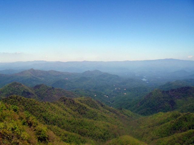
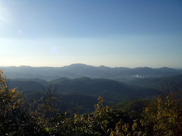
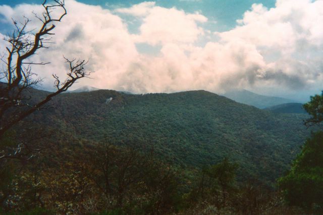
View from the tippy top of the lookout tower on Wesser Bald. Way out in the distance you can barely make out the Nantahala River.

25 May 2005

Rock Gap Shelter to Campsite on Wine Spring Bald

Appalachian Trail, 12 miles

Slept in a bit since I was in no hurry to get started today. I planned a low-mileage day -- only 7.5 miles -- but adjusted that plan later in the day. There was a beautiful full moon out this morning about 6 a.m. when I woke up. I went back to sleep till about 8. I could get used to this. My initial plan was to hike to the Siler Bald Shelter today and spend the night there.

Okay, before I go on, the word "bald" needs some discussion. Yank that I am, I had only ever heard the word "bald" used to describe people, not mountains. Turns out, a bald is basically a mountain with no trees on top -- just a broad grassy expanse. There's a lot of debate about what created these open spaces. Theories include fire, drought, insects, harsh weather extremes... some people even think that white settlers cleared these mountaintops as places for grazing their animals. (That theory seems a little odd to me... why would you march your herd 5,000+ feet up a mountain to graze?)

Anyway, it's kind of a surreal feeling to emerge from the tree canopy onto a broad, grassy mountaintop where you can see for miles. And that's what happened to me... I reached the top of Siler Bald (and the beginning of the shelter side trail) at about 1:30 p.m. Being so early in the day, it just didn't feel right to stop. Plus the side trail to the shelter was .6 miles long, and I thought I'd be better off investing my mileage in a forward direction rather than off to the side... so I pressed on, admittedly a little nervously, because that decision meant I was bypassing my only chance to sleep in a shelter tonight. I'd have to find my own stopping point and get out the ol' tent.

I ended up rounding out the day at 12 miles, and stopped at a little clearing near the top of a bald called Wine Spring. Doesn't that sound like a place you'd want to stop after hiking 12 miles? It is really beautiful here. My tent is up, a bear rope has been tied into a nearby tree for my food (and it sure as heck better work), my feet are up, and all is well. There are lots of birds around. I've been hearing a woodpecker pretty much nonstop since I got here. Hope he goes to bed when I do.

My cold is still plaguing me. Today, at Pete's suggestion, I perfected the very unladylike "farmer nose-blowing technique" -- that is, blowing my nose without the aid of a Kleenex. Sure makes a girl feel primitive. But desperate times call for desperate measures, and I'd rather save my dwindling Kleenex supply for use in the privy.

I was delighted to find that my phone works up here (I'm pretty high up -- about 5,400 feet) and once I got situated I dialed into my voicemail and got to hear messages from both Jay and Janet. That was a treat -- I miss my homies!

So it looks like tonight I'm all alone, in my postage-stamp-sized tent. I've set the thing up so that I can peek out the screen and get a good look at my bear bag. If my food's gonna go down, I at least want the thrill of watching it happen.

Hiking time: 5 hours (6:20 with breaks)
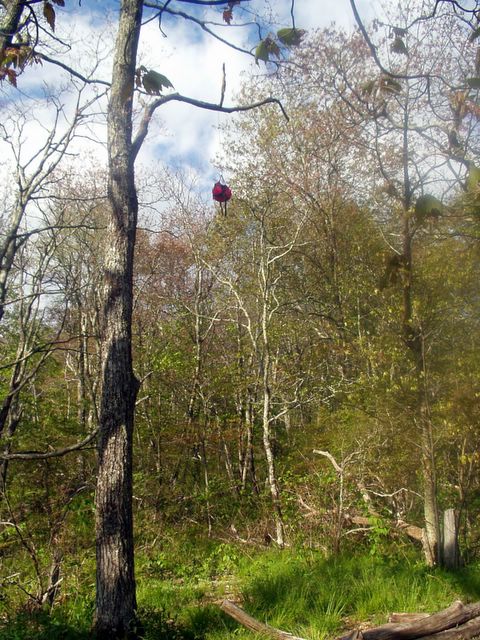
My little campsite near the top of Wine Spring Bald

That little bundle hanging way up there under the tree limb is my food. Go ahead and admit how impressed you are that I got it up that high....

24 May 2005

Carter Gap Shelter to Rock Gap Shelter

Appalachian Trail, 12.1 miles

Today's biggest accomplishment was summitting Albert Mountain, which kicked my tail. It was quite a scramble -- lots of hand-over-hand climbing, but what a rush when I finally got to the top! It was sunny, 70, and clear. Or as clear as it gets around here anyway... even on a clear day the Smoky Mountains still look, well... smoky. But could I ask for more? I think not!

As a bonus, my phone worked on the top of Albert so I was able to call Michigan and Maryland. Unfortunately, Jay wasn't home, so I had to leave a message. I really miss him. I did talk to Pete, though, and found out his test went well today -- yay! I really prayed for that. I wish I would've remembered to tell him how much I'm liking my trekking poles.

After conquering Albert I felt like I could pretty much do anything, I was so happy. But rather than speed-race all the way to the shelter, I took a long, leisurely lunch break at Long Branch Creek. My feet appreciated it. Speaking of the dogs, I used some stuff on my feet this morning called Body Glide. (Ed, the thru-hiker from the other night, gave me some to try.) It's an anti-friction product used by surfers, bicyclists, and anyone else who has problems with chafing or blisters. It looks like a miniature container of deodorant. Anyway, it worked great... no blisters all day long. I'll have to pick up some of that stuff.

The Rock Gap Shelter has a bear cable (the first I've seen in NC), but the shelter itself is kind of old and creepy. And I don't like the fact that it's so close to a road. They say that the best way to avoid crime on the trail is to stay far away from roads... so I was getting a little wigged out when it looked like I would have to stay here all night alone. I was really glad to see Randall, another hiker from last night, show up around 4:30. I never mind company at night. I haven't had to stay anywhere alone at night yet; I'm wondering if that will happen this trip...

Found out from Randall that Ed the thru-hiker saw a bobcat on his way out of Carter Gap this morning. Bears, then wild pigs, now bobcats. Is God mercifully making these beasts invisible to me so that I don't go charging terrified down the mountain and call Fred The Shuttle Man to take me back to my car? Or am I just so way off in my own thoughts that I'm oblivious to everything around me? Another case in point: at the top of Albert today two different people asked me, "Did you see that dead bear on the side of the trail as you came up to the summit?" Nope. Missed that. It blows my mind that I could be THAT inattentive! I guess I was so fixated on getting to the top of the mountain without causing heart stoppage that I couldn't see beyond the step or two in front of me. Makes me wonder what else I'm missing.

God is teaching me about small steps today... that even a slow, pitiful, tiny step is still a step toward the goal, and it's not always so important how fast I get there.

Highlights of the day: Summitting Albert Mountain, passing the hundred-mile mark on the AT.
Hiking time: 5 hours (7:15 with breaks)
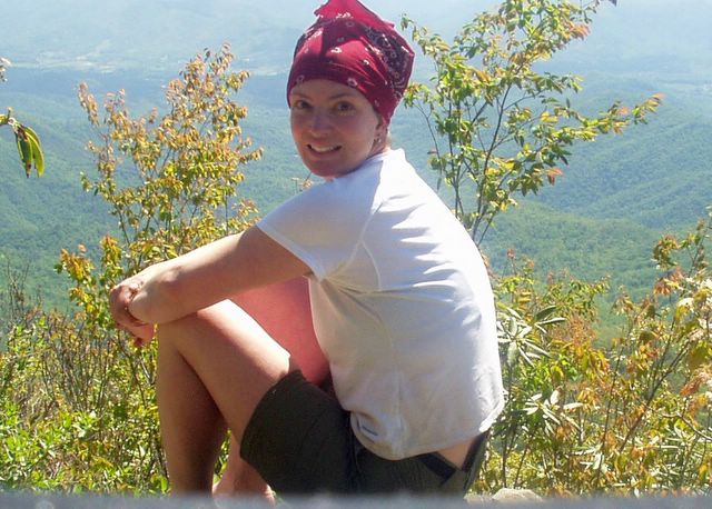
Me on the top of Albert Mountain

The view from Albert

23 May 2005

Muskrat Creek Shelter to Carter Gap Shelter

Appalachian Trail, 12.5 miles

Another hard day, but I'm feeling a lot better than yesterday. It helps to get an early start. It threatened rain this morning, but nothing ever came of it, so I'm really thankful for that. I'm still really congested, though, and I'm worried I'm going to exhaust my Kleenex supply. I really didn't bring enough for potty needs and nose-blowing...

Today was my longest mileage day of this trip. I summitted Standing Indian Mountain at about 11:45 -- it's the highest point I'll reach all week. I actually enjoyed the long, slow burn up the mountain.

I liked my poles even more today -- I think they're really helping me avoid fatigue in my knees.

Tonight's shelter, like last night's, has no bear cable. I wonder if that will be the norm in North Carolina? It bothers me a bit, but again, it's not so scary as long as I'm not alone. Tonight three other solo hikers showed up, so I'll let them fend off any bears.

I took a cold pill after dinner. I had hoped to avoid doing that, but the congestion was really getting to me. It's nice to be able to breathe through my nose for a little while.

Wayne, one of the other hikers, went out for a brief walk after dinner and came back white as a sheet. Apparently he was bumbling along, minding his own business, when he was approached by a small herd of wild pigs. Excuse me? Like the hakuna matata variety? No one told me there were wild pigs out here. Now I have to think about bears and pigs? Luckily they veered off the trail and left Wayne alone... I hope they do the same for me if I happen upon them.

Ed is a thru-hiker at tonight's shelter who reminds me of what Jay will be like in 25 years or so. He is a sweet, happy, joyful man, mid-sixties, who absolutely loves to take pictures. He tells me he takes about seven pictures for every mile that he hikes. He says he only travels about a mile and a half an hour because he's always stopping and fiddling with his camera. This made me understand why his wife didn't hike with him -- she would've killed him by now.

Tomorrow after I'm done hiking I get to change my clothes -- yay me! I'm sure I stink to high heaven.

Hiking time: 5 hours, 18 minutes (6:50 with breaks)
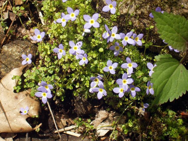
Wildflowers along the trail between Muskrat Creek and Carter Gap

22 May 2005

Dicks Creek Gap to Muskrat Creek Shelter

Appalachian Trail, 11.6 miles

What ever possessed me to think that this trip would be easy!? Oh my word, I thought I was in shape. Note to self: running five kilometers, three or four times a week, does not adequately prepare oneself for the trails in Georgia and North Carolina. Conclusion: the best thing to prepare your body for hiking the AT is... well... hiking the AT. Next time I will have to remember to give myself a day or so to get my trail legs.

It didn't help that I am on day three of a nasty cold. I am hoping this congestion goes away quickly. With all this snorting and sniffling, I'm worried I might be mistaken for Mary Ellen, that pitiful character in Bill Bryson's book, A Walk In the Woods.

I got a bit of a late start (10:15 a.m. or so) because I first had to park my car at Nantahala Outdoor Center and have Fred The Shuttle Man drive me to Dicks Creek Gap. I noticed right away that Fred held me in higher regard this time than last, when I was just a newbie. I think that my hiking 75+ miles in six days last October proved to him that I wasn't such a cupcake after all. (He might've thought differently, however, if he had seen how I clawed my way up Court House Bald, gasping for oxygen, mere hours after he dropped me off...)

Today was my first crack at using my new Leki trekking poles (thank you Pete and Cindy!), and I must say, being a quadruped took some getting used to. For the first hour or two I wanted to fling the dang things into the woods -- I just couldn't get any kind of smooth movement going, and it felt like they were really slowing me down. Once I quit trying so hard though, my legs and arms just fell into their own rhythm, sort of like cross-country skiing. By the end of the day I kind of came around -- now I think they're actually pretty useful.

The sand and rock here seem to be really quartz-y. When I stopped for a break today I happened to be studying the ground (translation: hunching over, leaning heavily on my Lekis, wondering if my lungs were going to explode right out of my chest) and I noticed that it almost looked like someone had spilled a bottle of glitter on the ground. Kind of pretty.

I misread my map and stumbled upon Muskrat Creek Shelter about a quarter mile earlier than I expected. First time in my hiking history that I've actually been ahead of where I thought I was... anyway, I just about danced a jig when I caught sight of the shelter. I suppose that would've rather alarmed Peter, a mild-mannered gentleman who had already staked out his side of the shelter and was beginning to cook his dinner. He turned out to be good company for the evening... he is fiftyish and recently retired from his position of VP at North Sails. Must remember to tell Dad about him. We chatted about Annapolis and sailing for a little bit, exchanged some stories about bats and hiking, and then I collapsed in a heap and slept all night.

There was no bear cable at this shelter, so we hung our food from a little mouse-proof (but definitely not bear-proof) suspension thingy in the overhang of the shelter. As the old joke goes, I figured I was safe from any bear that came along, as long as I could outrun Peter.

Saw lots of wildflowers today, one beautiful butterfly, and a pretty doe that wandered close to the shelter at dusk.

Highlight of the day: Finishing the Georgia section of the AT.
Hiking time: 5 hours, 2 minutes (7 hours with breaks)

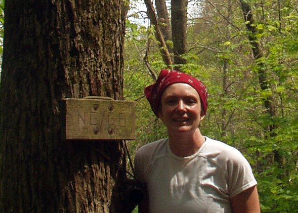
Hard to make it out, but the sign here says "NC/GA" -- it's the state line where I put the Georgia section of the trail behind me.

Butterfly along the trail to Muskrat Creek Shelter

21 May 2005

So, it's Trail-Launch Eve again...

....and I'm sitting here at a greasy diner in a little burg called Bryson City, NC, after driving all day. Tomorrow I start the next section of my Appalachian Trail hike.

I decided to take a different route south this time, so I could avoid the snarl of Pigeon Forge traffic and the tourists in Great Smoky Mountains National Park. So, I approached the trail from the west, on US129, which appeared (on my map, anyway) to be a lesser-traveled, straighter shot toward the trail. Smart, huh? I thought so too, till I got ten minutes down that road (which, for the record, is every bit as twisty and treacherous as the Blue Ridge Parkway in GSMNP) and suddenly found myself in the midst of a great horde of ageing, long-haired, leather-clad motorcyclists.

My mind flashed back to a sign I had seen in front of a church a few miles earlier: "Bikers Welcome." At the time, I had thought, "Hmmm, interesting ministry niche..." Now it all made sense. I soon learned from the banners strung about at the roadside parking areas that they were having a weekend-long rally called "Waken the Dragon." Sounds like an event where I'd fit right in, don't you think?

So, for about 28 torturous miles, I white-knuckled it around more hairpin curves than I care to remember, at a maximum speed of 25 mph, with at least 30 bikers fore and 30 aft. No exaggeration. I wanted desperately to pull over and let them pass, but all the pull-off spots were teeming with -- you guessed it -- more bikers, having the Hell's Angels version of a tailgate party. There were hundreds of them, sitting in lawn chairs, barbecuing, swilling Cokes.

So I just kept driving. Conspicously. In the middle of several dozen bikers. Oh yeah, you blend.

I exhaled violently in relief when the pack of Hogs in front of me spotted and claimed an empty pull-off area. But to my horror, the pack behind me stayed right on my tail. Good grief, now I was leading this parade! Judging from the backfiring and motor-belching sounds their cycles were making, I guess I was driving a bit too slow for their taste. Suspicion confirmed when suddenly they engulfed my little Altima, passing me with a deafening roar that left the air smelling a little like the afterburn of a cap gun.

When they were out of sight and my ears stopped ringing, I considered that maybe the Pigeon Forge tourists wouldn't have been so bad to deal with after all.

01 May 2005


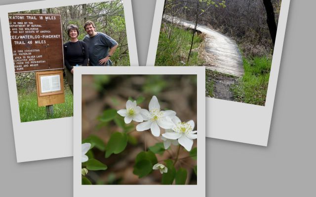
Photos by Jay, from our day on the Potowatami

Trail as Therapy

Cindy had the kids overnight and all day Saturday, so early in the week we decided we'd spend Saturday on the Potowatami. We ditched that plan Friday night because of rain in the forecast, but in the morning we woke up to only clouds (no rain), so we reverted to plan A, throwing some water bottles and snacks in the backpack and heading out to the trailhead at Silver Lake. We did the whole 17.5-mile loop in about six hours (5:10 not including breaks), and the first drops of rain fell just as we were climbing (crawling) back into the car at about 2:15. We were spent but happy.

The Poto was delightful as always, but what really hit me this time around is how therapeutic it was to spend the whole day hiking alongside my honey. Life is hard (no secret there) and our moments alone are few and far between. When we do get away for an evening here or there, it always seems so abbreviated. And so expensive! Dinner + sitter + movie can easily top a hundred bucks. Then we both feel this unspoken pressure to make that time "worth it" and meaningful. The problem is compounded if things don't go according to plan -- like on Friday night when we thought we'd see a movie together, and blindly walked into probably the lamest film we've ever encountered. (Apologies to those of you who somehow enjoyed The Hitchhiker's Guide to the Galaxy).

So Saturday morning we spent six uninterrupted hours together, surrounded by trees and flowers, talking when we felt like it, but comfortable being silent too. It is the best way of reconnecting that I know.

10 April 2005


Maria after her baptism

Maria being baptized by Pastor Chuck Jacob

Maria, getting ready to go in to Knox Church for her baptism

What a momentous day...

Even though it doesn’t count as an “outdoor” adventure, I am including the recap here because it is certainly an adventure in its own right. Not my own adventure, but Maria’s. Today she was baptized.

This has been a long time coming. She wanted to do it over a year ago, but we coaxed her into holding off a while. We wanted to make sure she understood what it was that she was doing. When she first starting asking about baptism, we did some talking and some reading with her, and found that there is a huge gap in the Christian book market – we were hard pressed to find a decent kids’ book that explains baptism really well. As God would have it, Knox offers a really great kids’ class by Jennifer Donovan on the sacraments, so she enrolled in that and we thought we’d just wait and see where things went afterward. That was last spring. Well, silly mum wrote down the date of the class wrong, so we missed the class (which is, unfortunately, only offered once a year).

Fast-forward to spring 2005. She is still really anxious about getting baptized, so we (re)enroll her in the sacraments class at Knox. This time we actually make it to the class, which is so well done that I think Jennifer ought to offer it for adults! We both came out of there having learned some things, and she was definitely still chomping at the bit, so away we went. After meeting with one of our elders, a wonderful man named Hershel Janes, she was, by everyone’s estimation, ready.

During her meeting with Hershel, she received a little booklet where she could record some of her thoughts about Jesus and her baptism. Here are a few snippets of what she wrote. The bold type is what was in the book, and the italics are what she wrote.

I love Jesus because: "he dide for me and others, and he is perfect, and never sinned."
I want to serve Jesus because: "he is the powerfullest person in Heven and Earth."
I want to celebrate because: "he is the Lord and my ferm foundashon.
I belong with God’s people because: I love him so much."

True, some of this is parroting what she has heard us or others say… but I know my kid, and I know that, as much as an eight-year-old is able, she understands salvation and has chosen to give her life to Christ. And this will be the most significant adventure of her life.

09 April 2005


Picknicking at Dolph Nature Preserve

The kids and I at Dolph Nature Preserve

We're really breaking the kids in...

...with some hiking this spring! Spent a few hours at Dolph Nature Preserve this afternoon, exploring the trails and picnicking. Now that Joe's old enough to run down a trail at breakneck speed, I see no end to the amount of exploring we could do! We had a great day -- amazing blue sky, sixtyish temp, and subtle signs of spring all around. I am fasting today, and it was a good opportunity to take in God's creation and thank him for it.

Prep for the AT is going well. I've been working out regularly, usually walking or running but sometimes slipping in a resistance workout just to mix it up. My legs will appreciate that when I'm clawing and gasping my way up Copper Ridge Bald (elevation 5,150).

This week I planned my food for the trip and packed most of it. Still have a few things to add just before I leave for Georgia: fresh-roasted pecans, cheese sticks, and a really shocking amount of peanut butter.

29 March 2005


On the nature trail at Kensington

We hiked a little at Kensington...

...with the kids today. It was the first day this year that the temperature approached 50 degrees, and it was muddy, messy, and beautiful! Maria especially was eating it up ... my heart leaps when I see her strutting down a trail, all confident and bossy-like. She was in the lead most of the time. I must get her out this summer for a backpacking weekend.

Speaking of Maria, I went into her classroom last week to talk about the Appalachian Trail. They are finishing up a unit called "Seeing the USA" and the AT seemed to fit right in. I let them try all of my equipment, made them some backpacker food, taught them a little about maps, and stuff like that.

22 March 2005

Two months from today....

....I will be starting the next section of "Appalachiapalooza," or my Appalachian Trail odyssey. Ever looked up the definition of odyssey? "An extended wandering or journey." That about sums it up. With an emphasis on "extended."

Note to self: start working out, in a punishing fashion, to prepare for many hours of upward climbing.

06 November 2004


On the Poto: Cindy, Janet, me, Pete, Nathan.

Another Day on the Poto

Potowatami Trail, 17.5 miles

Did the same route as on 25 September, this time with Janet, Cindy, Jay, Pete, and Nathan. It was a perfect hiking day -- clear and sunny, mid-fifties. Was really proud of Nathan -- it's a very long way for a 13-year-old! He and Pete took a shortcut near the end that shaved off about three miles, but still -- Nate was definitely the hero of the day. Janet made him a Boston cooler when we got home, and I made him a huge pot of rice!

Since traveling in a group slows you down, it took us 5:48 (net hike time) to complete the trail. It was starting to get dark by the time we finished. Maybe Jay and I will do this hike again in the winter or spring. I wouldn't mind making this an annual thing...

15 October 2004

Tray Mountain Shelter to Dicks Creek Gap

Appalachian Trail, 10.6 miles

Last day of this section hike -- bittersweet. Started out very early in bitter cold and wind. I am so happy it did not rain -- I think I would've died of hypothermia! Had to conquer a few moderate ups and downs, then huge, hard peak called Kelly Knob. Whoa. It was a big challenge. It was such a blessing to finally arrive at Dicks Creek Gap and see my car! I feel so proud of myself for completing such an aggressive, challenging hike.

Things I learned on this hike:
  • If there's a possibility the temperature will be in the fifties or lower, bring gloves, earband, and long underwear. I can't believe how cold I felt. I thought this was the south.
  • Bring a tea light for each night you plan to sleep in a shelter -- it seems to keep away mice and adds very little weight to your pack. Carl and Mike did this and it was nice to have constant light without worrying about flashlight battery life.
  • If possible, dunk your feet in a cold stream at the end of the day to ease fatigue and tame blisters. For all the jawing Louie did, this was one helpful tidbit that made it worth listening to him for three days.
  • Don't bring natural peanut butter or almond butter in plastic bags. The oil penetrates the bags and gets everything all oily. Eeew.

14 October 2004


For a brief moment, the rain cleared and I snapped this picture from the trail.

Low Gap Shelter to Tray Mountain Shelter

Appalachian Trail, 14.9 miles

Oh my word, what a hard day. Started in the rain and aggravated my blisters all day with wet socks and wet shoes. Even worse, it was a three-mountain day: Blue Mountain, Rocky Mountain, and (finally!) Tray Mountain. This day definitely felt like passing through the fire. I was so proud of myself for finishing.

By the time I got to the shelter the rain had stopped -- I was so thankful. Keith showed up later that afternoon. I was glad of this, because everyone else -- Louie, Carl, and Mike -- was done with their hike and had stopped at Unicoi Gap. It would've been spooky staying at the Tray Mountain shelter alone. It got very cold and really, really windy at night. I wore my gloves, earband, long underwear, pants, shirt, fleece, and raincoat to bed -- in my twenty-degree sleeping bag! -- and I was still cold. It rained much of the night and I worried about how I could stay warm and dry the next day.

13 October 2004

Blood Mountain Shelter to Low Gap Shelter

Appalachian Trail, 13.0 miles

Today I got up and started early because I was anxious to get to Neels Gap, two and a half miles down the mountain. There, I picked up mail from Jay and the kids, Janet, Eva, and a few others -- it made me cry and I miss everyone terribly. I don't know where my head was when I thought I could backpack alone for an entire month, let alone the week that I am undertaking right now.

It drizzled all day and started getting cold. I was the first at the shelter so I took Louie's advice and dunked my feet in the small creek running past the shelter. It helped tame a couple small blisters forming on the sides of each big toe. As I was standing in the creek in my undies (!) two thru-hikers arrived -- how embarrassing! Once I put myself back together, they introduced themselves as "Coyote" and "Ishmael." I hope those are their trail names and not their real names.

Keith and Louie showed up soon after, then Carl and Mike. So seven of us squeezed into the shelter! Once again, evening excitement: a small finch (which we at first thought was another bat) started flying at Louie's headlamp! Then there was a second one -- very bizarre! They both flopped around in the shelter, landing in turn on each of us, before Louie flung them underneath the shelter.

It rained hard from about midnight on.

12 October 2004


A very foggy view of Blood Mountain, from Justus Creek. Dang that thing looks big, even from this far away.

Gooch Mountain Shelter to Blood Mountain Shelter

Appalachian Trail, 13.6 miles

Another hard day -- 13.6 miles. In the rain. It rained hard last night but let up a little by about 8 a.m., so that's when I left. Made it here by about 3:30. It's a pretty stone building, built in the thirties by the Civilian Conservation Corps. I hear it's terribly mice-infested -- guess we'll see tonight.

It was very foggy all day today due to the rain, so there's no view at all from this peak. Kind of disappointing, but I'm just glad I made it to the top. Saw a cute little turtle on the trail this morning.

Update from later in the evening: No mice in the shelter, but a bat flew in just as everyone was going to bed! Louie ("Black Cloud") was there; also Keith and two really funny guys from Jacksonville, FL named Carl and Mike. The bat generated quite a bit of excitement till it flew back out the window. Also: no bear cables in this shelter area; not sure why. So we all hung our food from the beams inside the shelter, which seemed questionable to me but since I'm such a bad food-hanger I didn't protest. No animals bothered the food, so I guess this was okay.

11 October 2004

Stover Creek Shelter to Gooch Mountain Shelter

Appalachian Trail, 12.2 miles

What a day! It kicked my tail. Lots of ascents and descents that never seemed to end. I am so thankful to be at the shelter. Keith ended up here too, about half an hour ahead of me, along with a very quiet young couple and a sort of loud blow-hard type guy who calls himself "Black Cloud" (!). (This business of trail names is so bizarre to me!) He is a piece of work; I'll leave it at that.

There is some sort of military base near the trail and today as I was sitting by a creek, taking a break, I watched five astonishingly loud Blackhawk helicopters fly directly overhead, very low. That was about all the wildlife (!) I saw today.

Though it continues to be overcast, I was thankful again for no rain today.

The Gooch Mountain Shelter is new and nice -- it has a loft and nice picnic table and large overhanging roof. This shelter (and the Stove Creek shelter I stayed in last night) has a cable system nearby which you can use to hang your food out of reach of bears. I'm guessing all the shelters have this, at least the ones in Georgia. I hope so, anway.

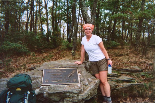
Here's me at the top of Springer, still looking relatively clean and perky. I was pretty pleased with myself for having made it to the top in short order. At this point I only had about three miles before I got to my first stopping point (Stover Creek Shelter).

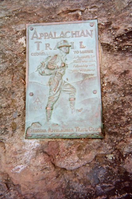
After a strenuous hike to the top of Springer Mountain, you're rewarded with this plaque, which marks the official beginning of the AT. It's hard to read it from my crummy picture, but the small writing says "A footpath for those who seek fellowship with the wilderness." How cool is that!?

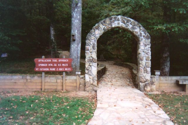
This is what the approach trail looks like at the very beginning. It seems like an evil trick, but you actually start here and then have to hike 8.5 miles just to get to the beginning of the Appalachian Trail! Note the third line on the sign: Mt. Katahdin is 2,108.5 miles away.

Starting at the Beginning

The launch of my Appalachian Trail adventure! Amicalola Falls visitor center to Stover Creek Shelter. 11.3 miles

Left the car at Dicks Creek Gap and I-76, and got shuttled to the beginning of the approach trail. It was tough at times -- steep inclines that take you to the top of Springer Mountain. I'm staying in an AT shelter for the first time, with another solo hiker named Keith, who seems nice enough. I feel really good -- no hip pain at all, and no blisters. I'm eating less than I thought. There were lots of other people on the approach trail today -- I bet I passed like 25 people! But Keith is the only one I've seen since starting the "official" part of the AT.

I don't feel too spooked at all about being alone (surprisingly!) except there was this one stretch of the trail that was dark and tunnel-like because of all the overgrowth. Reminded me of something out of The Magician's Nephew or something. There I felt a little funny, but the landscape changed quickly and I was fine. I must admit, though, that I'm kind of glad this Keith guy is here. He showed up at the shelter about an hour after I did.

Yay for me! First day of my section hike done! Total miles = 11.3, in about six hours including breaks.

25 September 2004

Poto, Solo!

Potowatami Trail (all of it!); 17.5 miles

Hiked the whole Potowatami Trail, solo! On the DNR map, started at "1" and went counterclockwise around. Took a wrong turn near "9," but was thankful for it because I saw a beautiful doe starting at me through the trees. Saw little wildlife otherwise, unless you count three tiny kittens playing trailside just north of Hiland Lake. Also saw three hunters -- two were standing right on the trail together; the other was about a mile further up and spooked me a little as he was crouched in the woods, holding his gun and looking at me (!). At that moment, my little orange bandanna, which I had worn on my head to be noticeable in case I encountered hunters, seemed woefully inadequate.

I took only one short break and finished the trail in a little over five hours. My hips were sore afterward and into the next day -- that's never happened to me during a hike! Getting old I guess. Then again, this is (I think) the highest mileage day I've ever had. I was happy to see a bench at point "9" (west end of the shortcut) where I ate my lunch. That was about halfway.

I felt empowered and happy about doing this hike alone, especially becasue my AT launch is just two weeks away. I was distrubed, though, to find out that the day after I hiked, a woman (who was also alone) was robbed on the trail. Yikes.

Update re: the woman who was robbed. I was misinformed; she wasn't robbed on the trail; she was running on the trail and came back to the parking lot to find out that her car had been broken into. Still. You want to be able to trust people in a place like this.

12 September 2004

Ten-mile loop on the Potowatami Trail

Pinckney State Recreation Area. Ten miles in about two and a half hours.

The weather was amazing for this beautiful morning hike. Jay and I started at "1" on the Potowatami Trail, headed to "2" and then "9." (All these numbers are on the DNR map they give you at the park office.) From there, we took the Crooked Lake Trail past "8" and over to "3." Took the Silver Lake Trail to "4" and then got back onto the Poto, to "6," then to "5," then "7," then back to "1." Excluding one break for snacks and water, this hike took us about two and a half hours. Most of it was quite flat.

20 August 2004


At the Blue Ridge Summer Overlook, Catoctin Mountain National Park

There's a National Park in Maryland?

Catoctin Mountain National Park, Maryland. About 8 miles; 3:15 excluding breaks and lunch.

Jay and I broke in our new trail shoes. Started at the visitor center and did the east loop (visitor center to Wolf Rock, then to Castle Rock, then circled around toward Crows Nest. Also did the west loop to Blue Ridge Summit Overlook -- nice lunch spot! -- then to Hog Rock, then Cunningham Falls, then back to the visitor center. Saw very little wildlife; just some chipmunks and a small garter snake. But the terrain was beautiful. Very hilly and rocky. The falls were pretty but the boardwalk/lookout thingy didn't provide a good view so (of course) Jay hopped the fence and went prancing halfway up the falls rocks to get a better look (and get a little wet). It was hot (in the nineties) and humid but not unbearable under the tree canopy.

Lesson learned: Bring sunglasses even if your hike is shaded by trees, as it can keep the gnats from dive-bombing your eyes.

09 July 2004


Is that really me, or did I just dream that I did that?

"Air Traffic Controller" has an entirely new meaning to me now

Orderville Rappel, Zion Ponderosa Ranch, Utah

Though technically this was a rappel and not a hike (the hiking part lasted only a short time -- about a mile or less), I'm putting this in my hiking journal because I feel the need to memorialize the fact that I actually did it. Outside of the practice rappel down the side of the Zion Ranch activity barn, this was my first real rappelling experience, and it scared the wits outta me.

Jay and Cindy and I hopped in a suburban with Amber and Staci from East Zion Adventures, and drove out to a 150-foot dropoff on ranch property. The road to get there (the same one we used when we did the Orderville Canyon hike on July 6) was a rocky, steep, dry riverbed that required four- wheel drive and a lot of machismo to navigate. It was enough to nearly shake my breakfast loose. Luckily I had very little breakfast in me, because I had trouble eating anything that morning, I was so worked up about rappelling. The terrain we drove on was so choppy I'm surprised we didn't blow a couple tires.

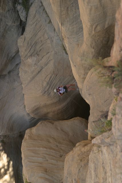
We parked the suburban about 9:15, loaded up some backpacks with our equipment, and hiked about 15 minutes out to our cliff. Each of us rappelled down twice. Staci stayed at the top to check our harnesses, and Amber belayed at the bottom. The first time was down a lumpy, steep rock face. My arms felt so shakey I was worried that I might not be able to trust my right arm to hold myself up.

My left arm was none too steady, either, as it was busy feeding rope through a flimsy-looking little piece of metal that climbers and rappellers (a very witty bunch) have cleverly dubbed an "air traffic controller." Hard to appreciate the humor in the name when you're watching that thing, bug-eyed, wondering if it's going to give way and send you smashing into the side of the cliff.

But everything went fine and I felt pretty empowered at having made it to the bottom of the cliff in one piece. When I finally landed, I realized that I had been gripping the rope so tightly with my left hand that I could barely pry my fingers open. My hand ached for several minutes and felt like it might fall right off my arm.

For the second rappel we switched the ropes over to a "keyhole," a deep crevass in the side of the cliff, and rappelled down the inside of it. At first I didn't think I would do the second rappel, because my hand hurt so badly the first time, but everyone else talked me into it and down I went. Peer pressure is an amazing thing. I'm really glad I did it, though; it was so cool to be inside of that crevass, looking up, looking down, and really enjoying the experience rather than just breathing through the terror (which is all I did the first time). My left hand was fine, but I had to keep reminding myself to loosen my grip.

High point: Conquering my fear of rappelling. I feel pretty comfortable with this now and would actually do it again. Would even be interested in something higher or more challenging. (Did I actually say that?)

08 July 2004


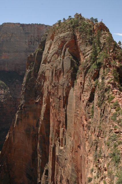
This is the fin of rock they call Angel's Landing. It's enormous. We climbed right up the spine of this bad boy.

Afraid of Heights? No problem, just don't look down.

Trek to top of Angel's Landing, Zion National Park, Utah. Five miles, ~4 hours including breaks and lunch.

I had no idea how challenging this hike would be! It is dubbed the "most strenuous" frontcountry hike in Zion National Park, but who knew it would require climbing straight up for two and a half hours?! Cindy and I hiked together, leading the way (Cindy claimed a "pancake advantage" due to the lavish breakfast at Zion Ranch just before leaving for the park.) Janet and Jay brought up the rear. We started about 10 a.m. and got done at 2 p.m. (yes, doing this hike during the sunniest, hottest part of the day was not the best decision).

The first mile or so went okay, with a steep but manageable grade. Then we got to this interesting area called Walter's Wiggles, which got steeper and more difficult. Then we got to the last half-mile of the climb, where the park has installed metal chains to hang onto at some of the more dangerous spots, so you don't go skittering down the rock face to your death. (A Boy Scout died that way just two weeks earlier, and he fell so far it took two days to recover his body. Really.) It was probably the most difficult hiking I've done. The height bothered me a bit, and I couldn't discipline my mind enough to quit thinking of falling. At some points, the steep, rocky path was only a foot or two wide, with steep dropoffs on both sides. But it was worth it to get to the top, which was 1,500 feet above the place where we started, and the view there was spectacular.

Quote of the day (from Janet): "I'd hike Orderville Canyone three times before I'd do this again!"

We dragged our sweaty, bad selves into Springdale after our descent and enjoyed ice cream and cold pop.

06 July 2004


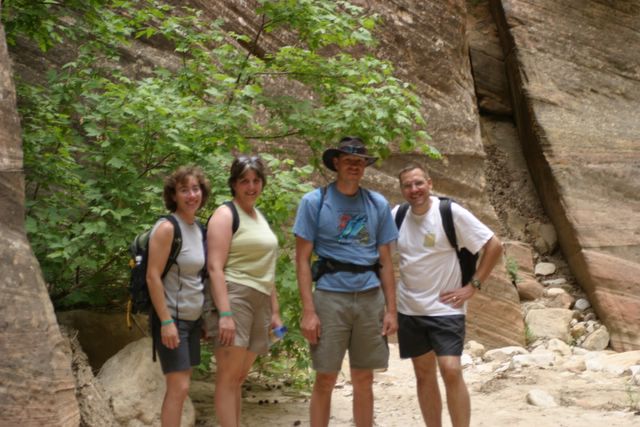
Cindy, Janet, Daniel, and Jay in Orderville Canyon

Conquering Orderville Canyon

~12 miles, starting at Zion Ponderosa Ranch and winding through to the Virgin River in Zion National Park, Utah. Took ~7 hours including breaks and lunch.

Hiked Orderville Canyon trail with Jay, Cindy, Janet, and a guy named Daniel, who saved our hides. We started out on ranch property, hiked a steep switchback trail down to the canyon, and hiked a dry riverbed for about five or six miles. A trickle of water appeared eventually (spring-fed I think?) and turned into a small river about half the width of Mill Creek. We hiked the remaining six or seven miles through sixty-degree (read: cold) water, sometimes an inch or two deep, sometimes over our heads (!). It was very difficult to navigate over some of the steep boulders, particularly a couple of chokestones which have created dropoffs measuring about fifteen feet. There were a few areas where we had to use webbing to navigate our way down. Our first exporsure to "technical" hiking! It was a bit scary but pretty exhilarating.

In three or four spots we needed to climb or slide down huge boulders into deep water and swim across the deep parts until we could regain our footing. One time I plunged all the way under, after jumping from the two boulders between which I was (very daintily) wedged. We all got thoroughly soaked, as did our packs. Thanks to Daniel's swimming skills, Jay's camera actually survived with only a scrape or two -- no water damage. We were all amazed about that.

Daniel is part of the family who owns Zion Ponderosa. He had hiked this trail nine times already, so he pretty much knew what we were in for around every turn. At the hard parts (like areas that required submersion in water!) he went first so we could see the best way to negotiate the terrain. He also caught us a couple times when the climb down a boulder was especially hard. Without him it would've been, at worst, impossible, and at best, emotionally draining and nerve-rattling, to complete this hike.

Next time I would wear boots intead of my New Balance trail shoes.

High points: Seeing Cindy conquer some of her fear of deep water. Admiring God's artistry and immenseness in the huge rock sculptures, slot canyons, and boulders.

Low point: Slipping on a submerged rock and hammering my right knee pretty hard, at about mile 10. I was getting tired and sloppy.